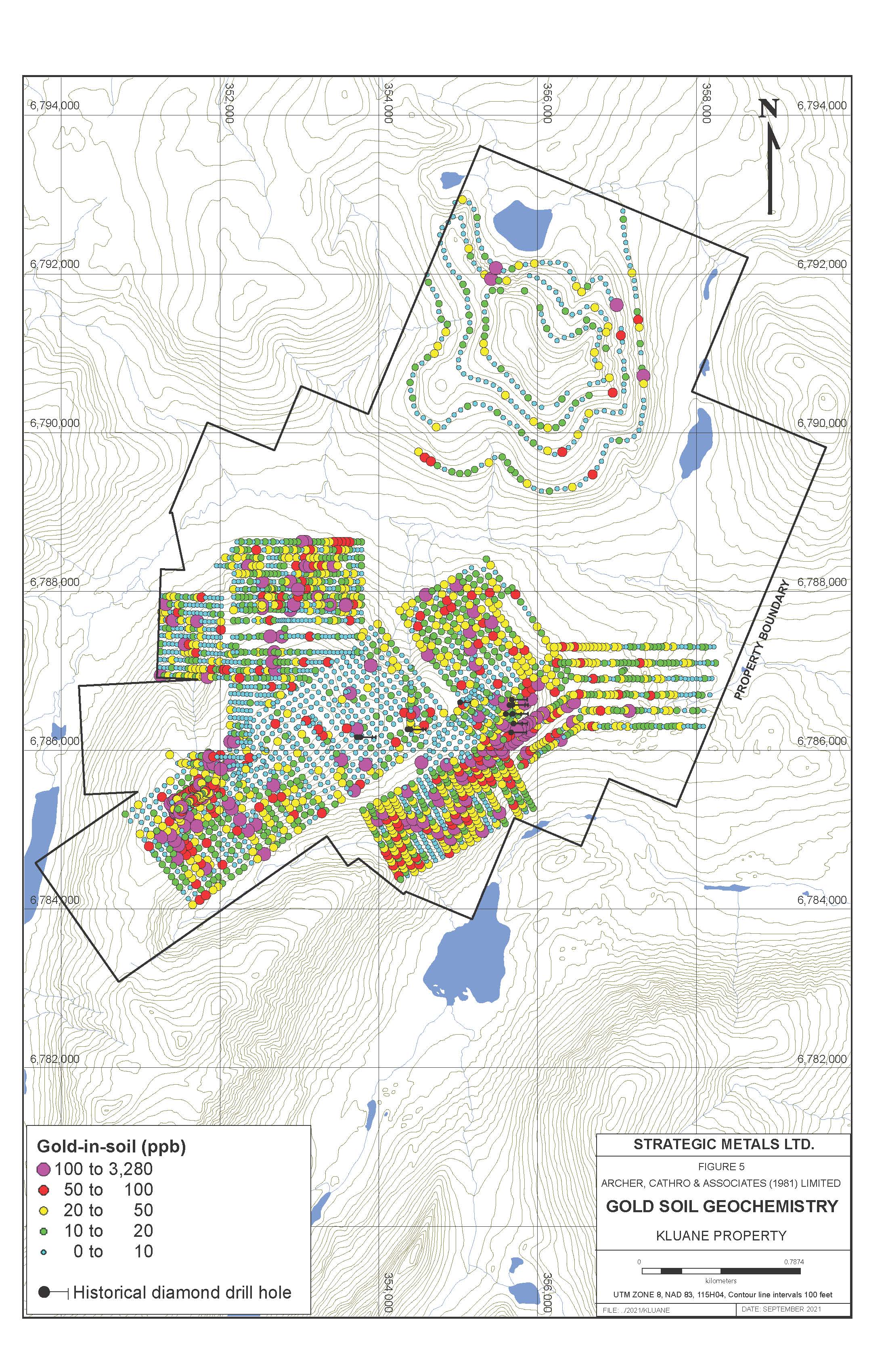
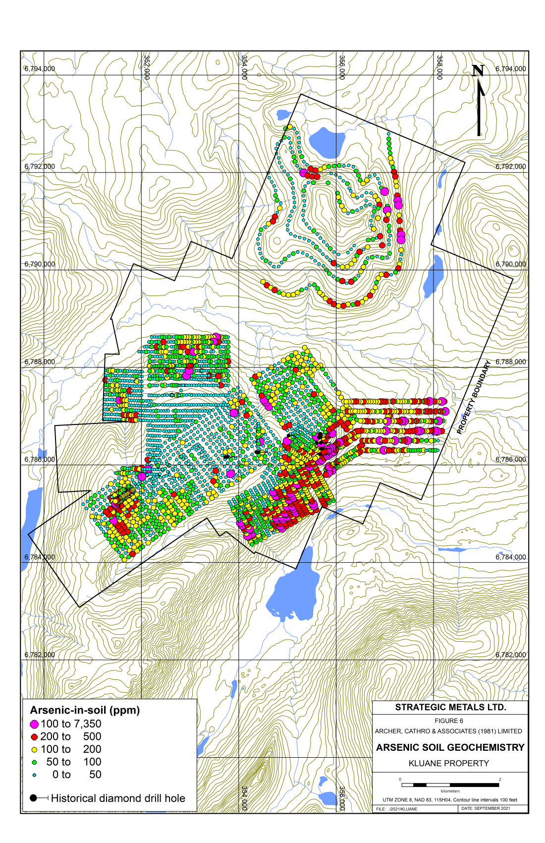
Kluane
- Under explored gold camp covering 68 km2.
- Located 46 km north of Haines Junction and 33 km west of a major hydroelectric generating station.
- Hosts several high grade, epithermal or orogenic gold vein zones.
- Gold occurs as native gold and with arsenopyrite.
- Mineralization is dated at 57 Ma
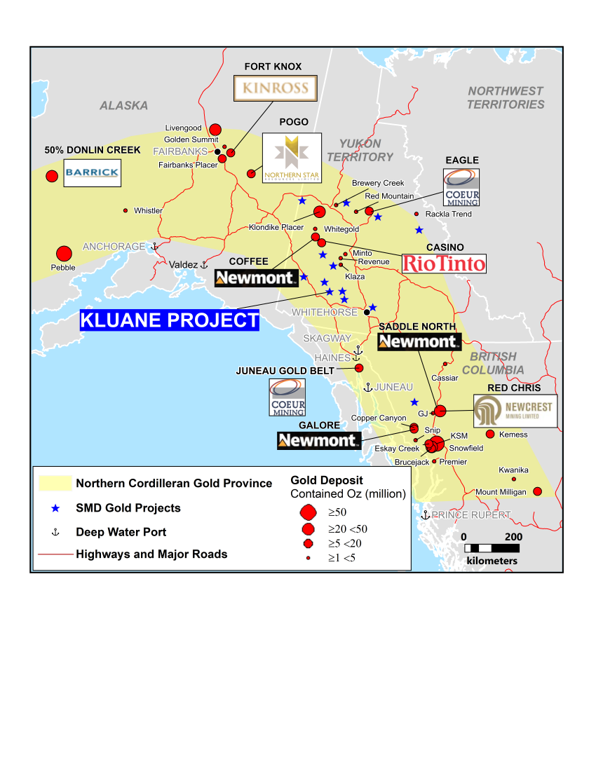
- The style and age of the mineralization and the general geological setting closely resemble deposits in the Juneau Gold Belt.
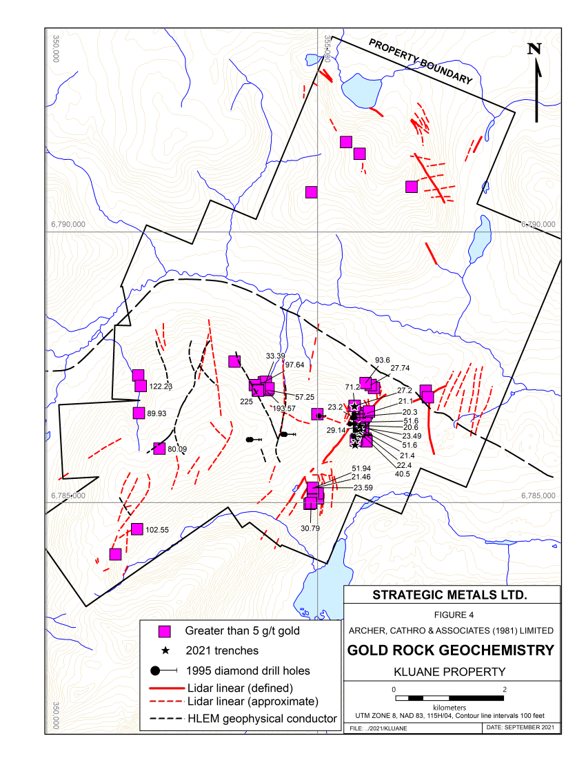
- A LiDAR survey flown in summer 2019 identified large scale structures linking known showings.
|
Zone |
Highlight |
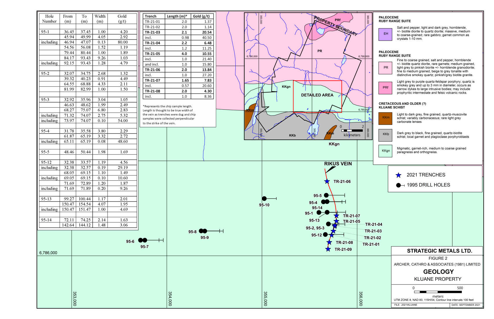
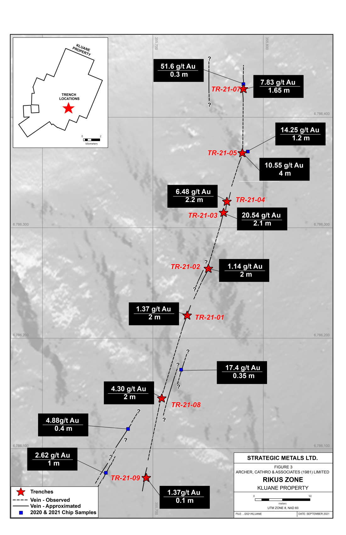
| Rikus | Drill hole: 2.83 g/t Au over 6.80 m |
| Chip: 7.36 g/t Au over 9.5 m | |
| Delor | Grab: 225 g/t Au |
| Chip: 9.22 g/t Au over 2 m | |
| Dal Bianco | Chip: 14.07 g/t Au over 0.15 m |
| Ross | Trench: 19.06 g/t Au over 1 m |
| Malou | Drill hole: 1.06 g/t over 1.13 m |
| Sack | Grab: 6.85 g/t Au |
| Switchback | Grab: 10.15 g/t Au |
| Shut | Grab: 122 g/t Au |
| North Shut | Grab: 2.39 g/t Au |
| Arc | Grab: 9.95 g/t Au |
| Metallica | Grab: 8.71 g/t Au |
| Slayer | Grab: 11.8 g/t Au |