Mint Project
Gold-Copper porphyry discovery near the Alaska Highway
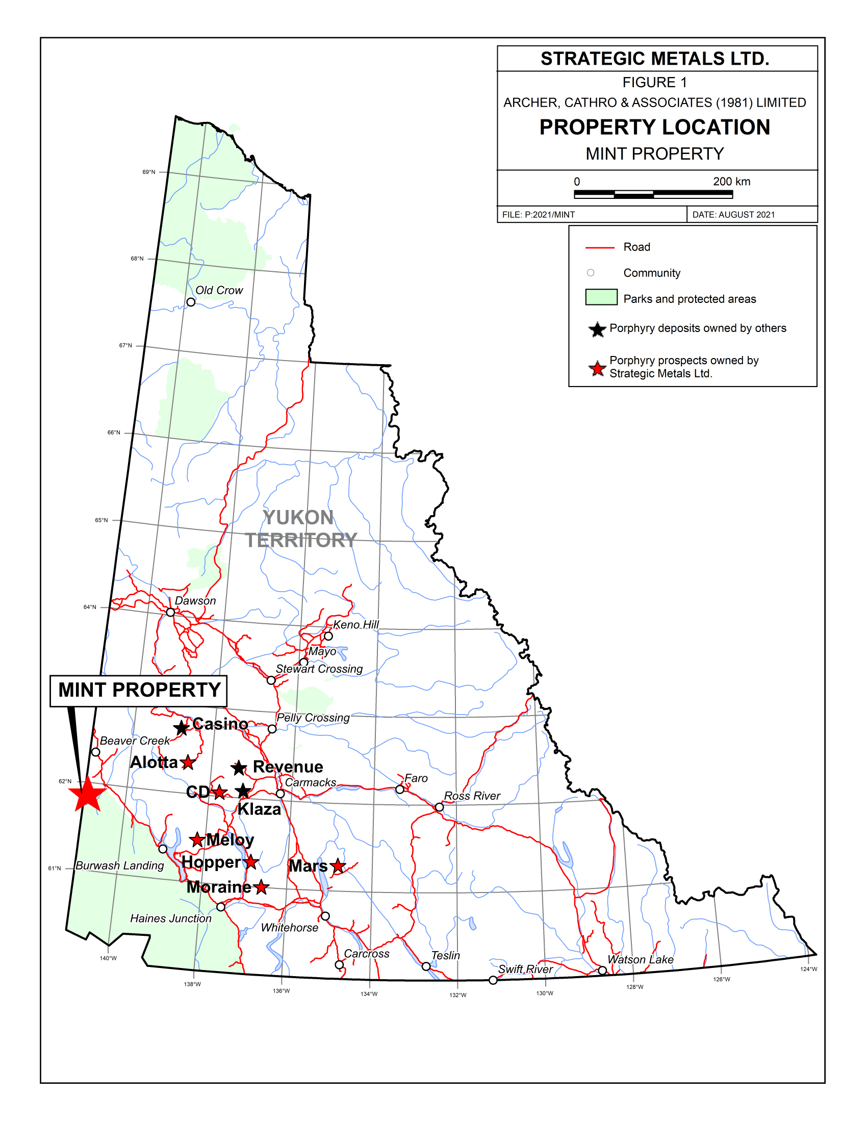
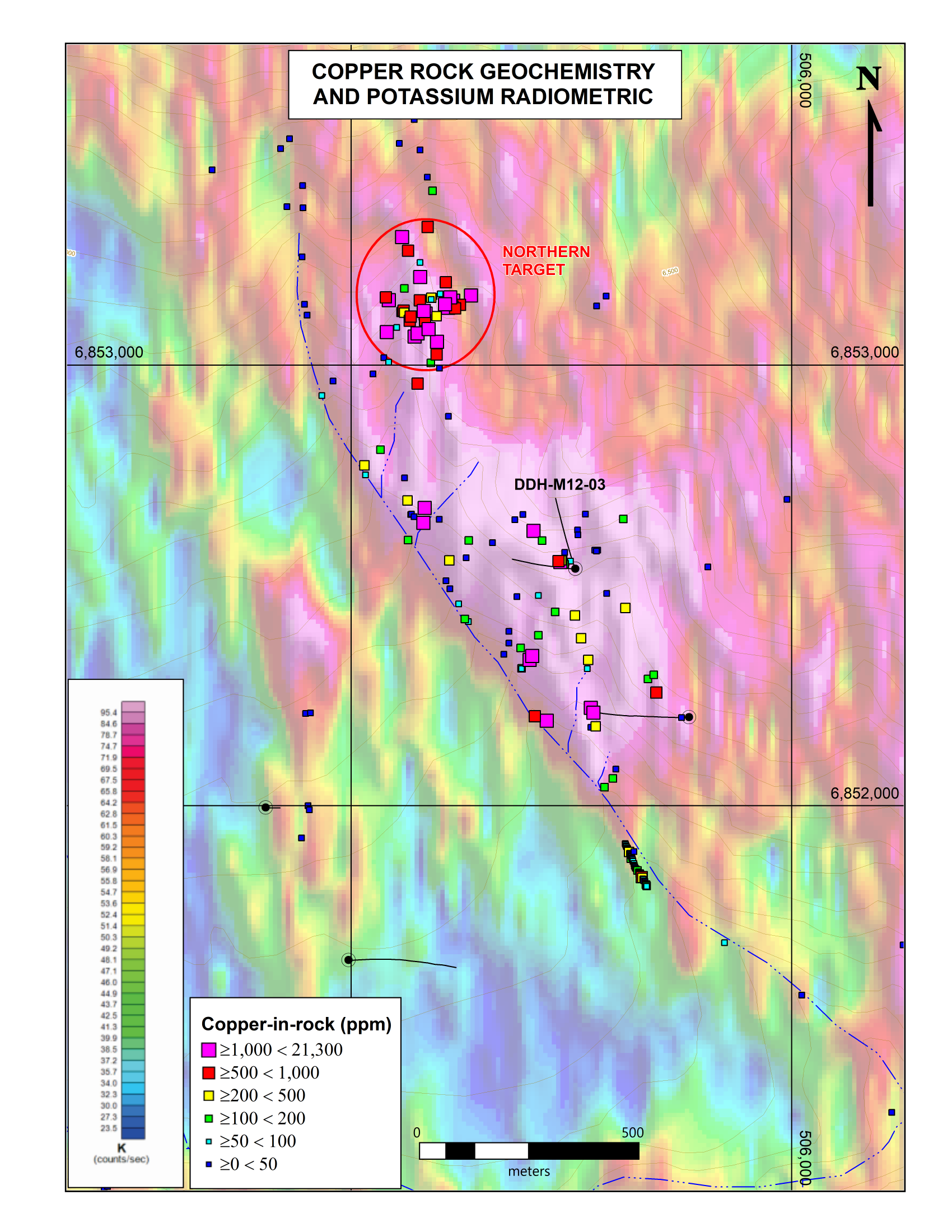
The Mint project is located in southwestern Yukon approximately 26 km southwest of the Alaska Highway within the traditional territory of the White River First Nation. The property hosts alkaline-type porphyry gold-copper-molybdenum mineralization that was discovered and staked in the early 1980s, but received only reconnaissance-scale exploration at that time. Geological, geochemical and geophysical surveys conducted by Strategic in 2010 returned encouraging results, including a helicopter-borne versatile time domain electromagnetic and magnetic survey that outlined a circular magnetic high approximately 2,200 m in diameter. This magnetic high is centred on a high level, Mid to Late Miocene dyke of intermediate composition, which cuts approximately coeval, basic to intermediate volcanic flows and related pyroclastic and sedimentary rocks. Areas of intense silicification are present within a broader zone of sericite-pyrite alteration developed in and around the dyke.
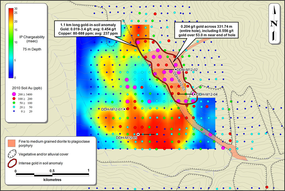
A 1,100 by 500 m core of moderately to very strongly anomalous gold values (100 to 3,400 ppb) coincides with the strongest alteration and a potassium high defined by a helicopter-borne multispectral radiometric survey. The core of the gold anomaly lies within a larger zone of elevated gold, copper and molybdenum values, which encompasses an area 1,000 m wide and 2,100 m long. IP/resistivity geophysical surveys were conducted over much of the geochemically anomalous area during the summer of 2011. These surveys identified extensive zones of high chargeability and low resistivity.
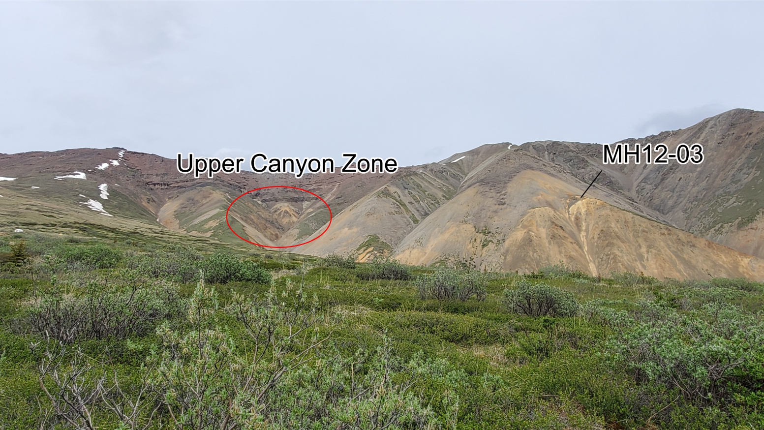
A 2012 drill program at the Mint project consisted of five widely spaced holes totalling 1,765 m. The holes evaluated various parts of the geochemical and geophysical anomalies. Four of the five drill holes yielded long intervals with highly anomalous but sub-economic levels of gold (hole M12-01 was terminated well short of its target depth due to poor ground conditions). The best results are from near the bottom of the most northerly hole (M12-03). That hole averaged 0.204 g/t gold across its entire length of 331.74 m and included an interval that graded 0.556 g/t gold over 53.0 m.
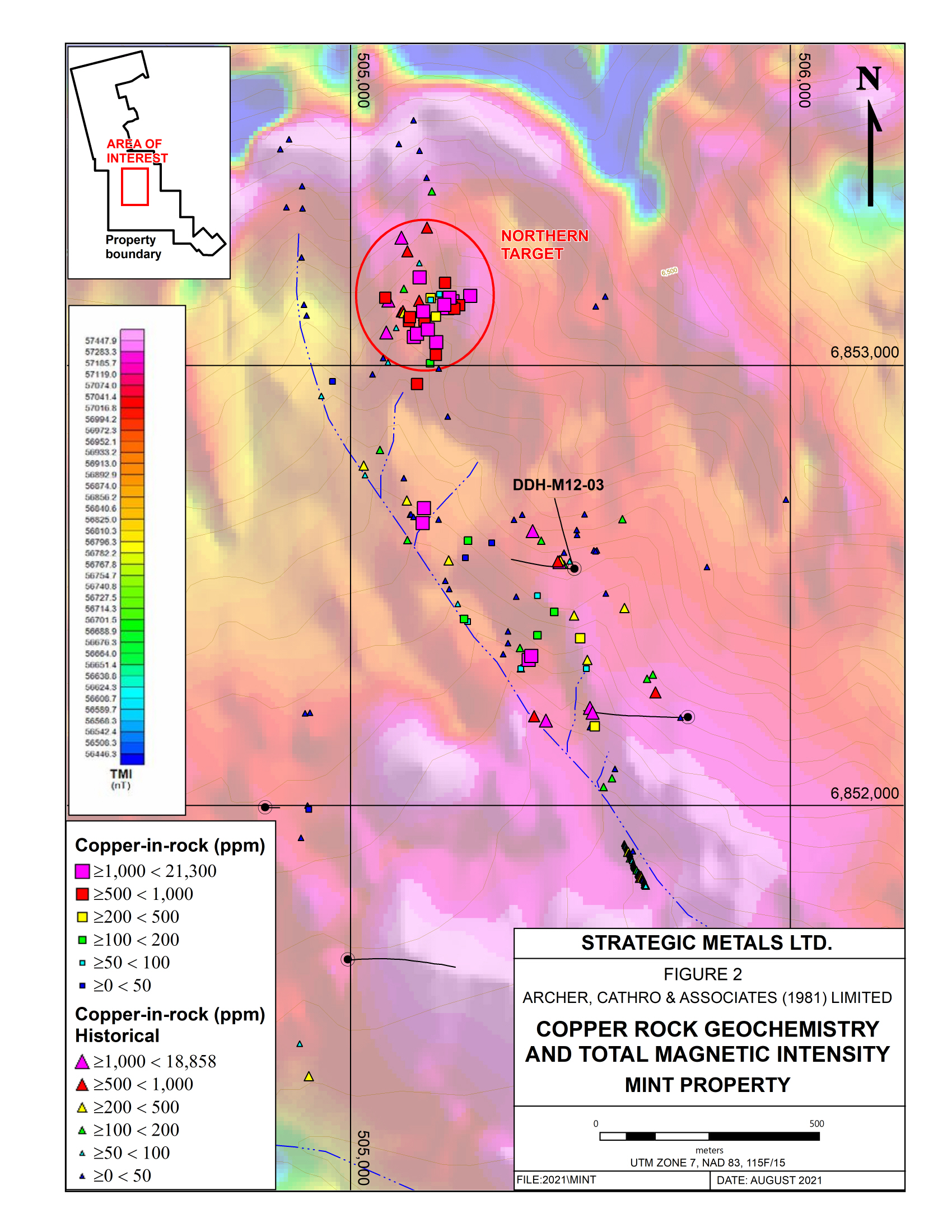
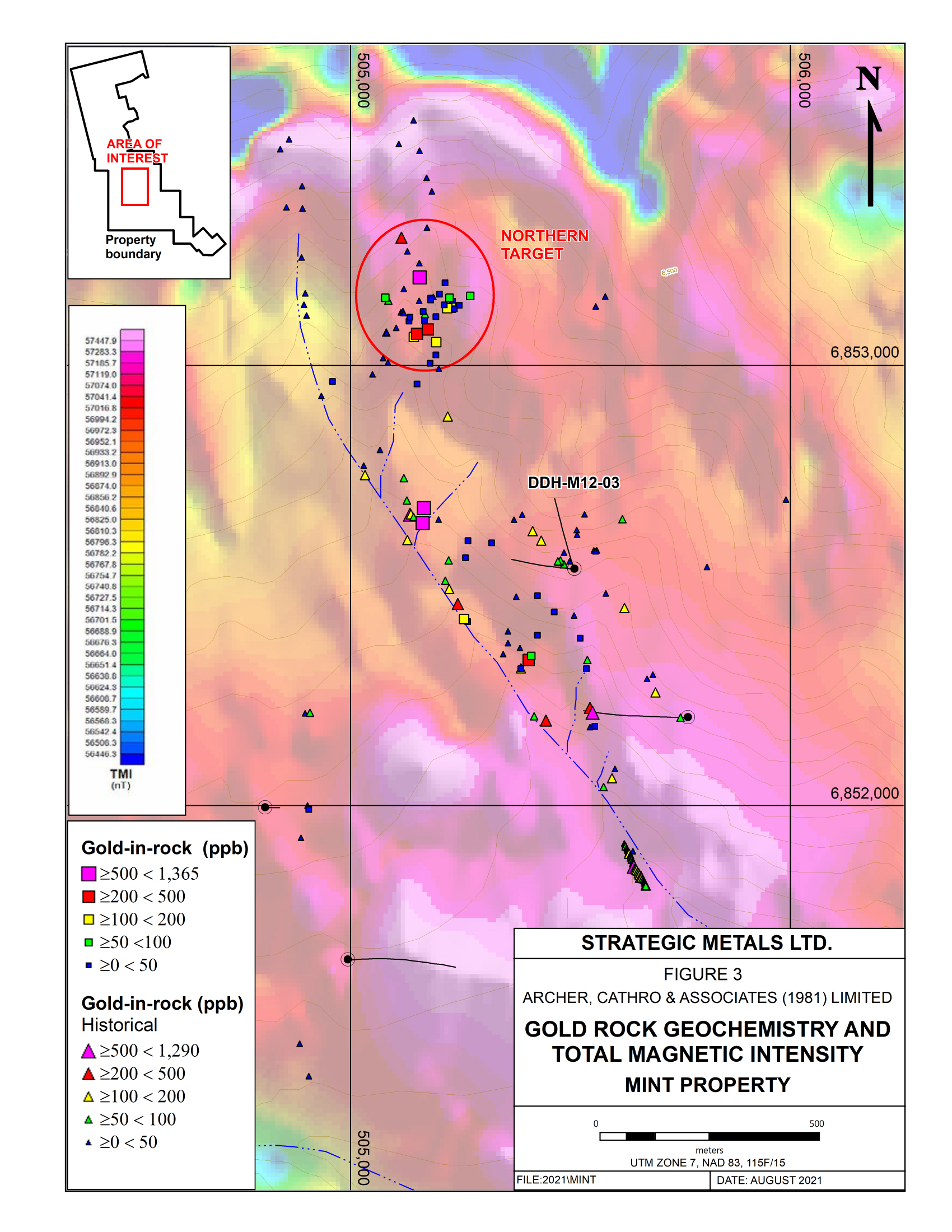
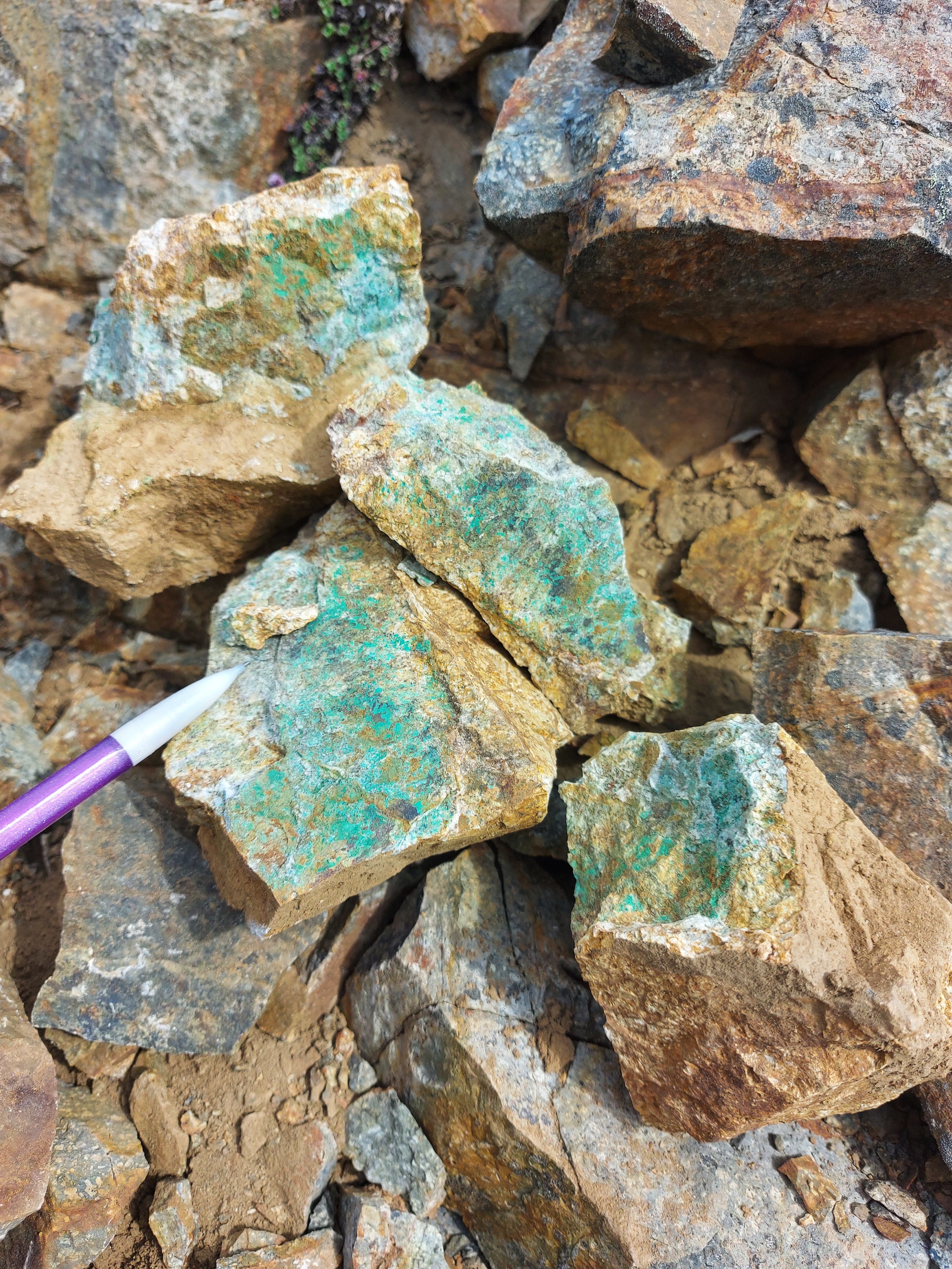
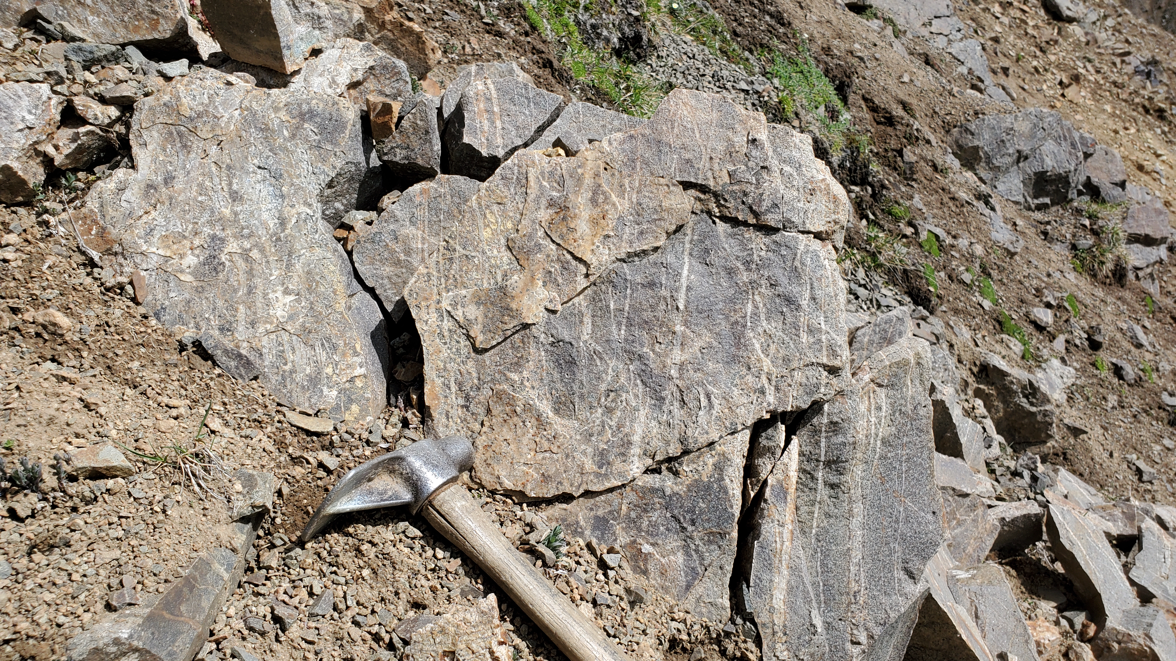
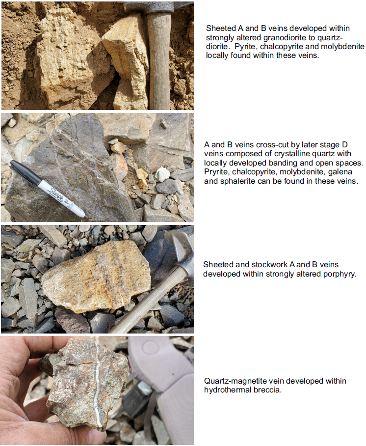
In July 2021, the Company sent a crew to the property to perform detailed mapping and rock sampling within a promising target that lies 800 m north of the area where the maiden drill program was conducted in 2012. The work identified a 300 m by 300 m area containing porphyry-style alteration and veining with abundant copper mineralization. Chalcopyrite, pyrite and rare molybdenite occur within veins, and chalcopyrite is present in wallrocks where veins form more than 20% of the rock. Sulphide mineralization has been weathered to limonite in many locations.
The average values for the 26 rock samples collected in 2021 from the northern target are 0.32% copper, 0.088 g/t gold, 5.7 g/t silver and 0.038 % molybdenum.
Qualified Person:
All technical information contained has been approved by Heather Burrell, P.Geo., a geological consultant to Strategic Metals Ltd. and qualified person for the purposes of NI 43-101.